The drive on Hwy 89 from Sunset Crater to Page, AZ, is an eye-opener. Pretty much a straight shot, both the eastern and western horizons featured magnificently eroded red cliffs. The wide valley between is the home of several native American tribes, and a local public radio station hosted an interesting call-in show discussing the current drought. Everywhere we looked was at one time sculpted by water, yet none was visible. What did capture our attention were the number of vehicles tethered around barren clusters of manufactured homes with few, if any, trees as contrast. And now and then an entrepreneurial outpost vending native American wares.
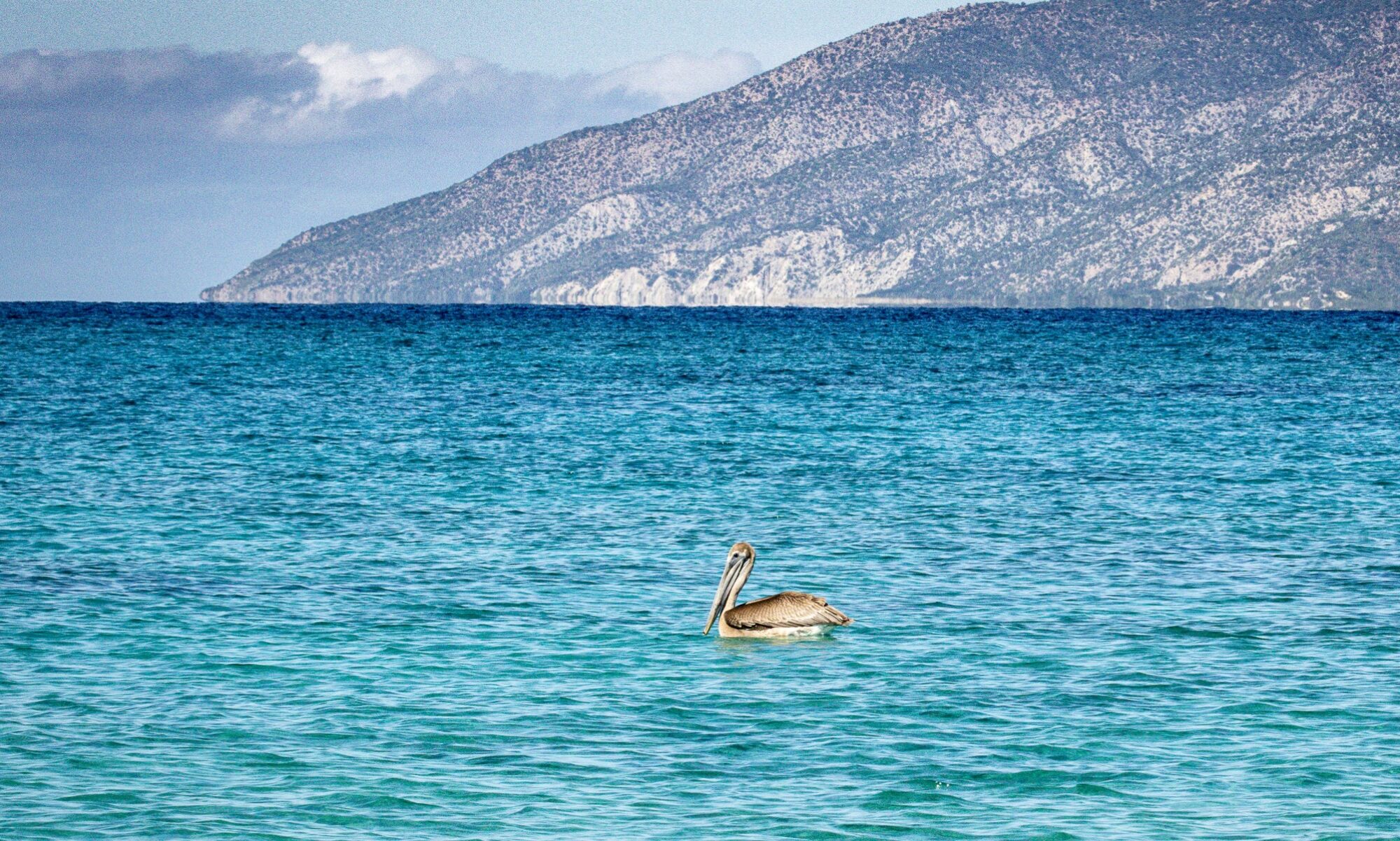
As we approached Page, it was apparent how this town is affected by nearby Lake Powell with the huge hydro-electric dam and adjacent power plant that made it all happen. The water level in the lake was considerably below observable “normal” levels, but we observed plenty of marine activity on the water as we crossed the dam into Utah.
Our original plan was to hike into the famous Antelope Canyons just south of Page. We’d been introduced to these by both friends who’d visited and by extensive exposure on the ‘Net and through fabulous photo essays in Arizona Highways magazine. Their beauty notwithstanding, it was the commercialism by the Native American tribes managing the slot canyons that turned me off. I’d learned of another series of slot canyons accessible 26 miles beyond Page called the Coyote Buttes area. This area is managed by the BLM and the $5 day use is a fraction of what visitors pay the tribes for their timed, pay-by-the-hour visits.. We were not disappointed with what we discovered in Utah.
Getting there was easy. Shortly after crossing the state line, a BLM visitor’s center provided us our day-use permit, helpful maps and directions, and we set out on our adventure. Continuing west on Hwy 89 toward Zion Nat. Park, we turned off the highway just before milepost 26 onto Horsevalley Road and headed south on that dusty road for about 6 miles to the Wire Pass (canyon) trailhead. The road’s surface is mostly wash-board, and when wet can really be treacherous. A few days earlier, some rain evidently transformed the road into a luge course that must have made driving nerve-wracking; vehicular tracks were both on and off the road, with some more off than on. Our drive was dusty and uneventful with the exception of the extraordinary beauty of the nearby hills.
The Wire Pass trailhead features a clean latrine and not much more. Some people pay an extra $5 to park overnight there when hiking the entire length of myriad of canyons originating there, but we parked with a glorious day hike in mind. The first ½ mile was mostly slogging along in the soft sand characteristic of most washes, and having set out at 3:30 pm, the sun was still pretty high.
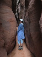
Suddenly the walls of the wash closed in on us and in no time, we were in remarkably narrow “slot” canyons. Their colors reflected the red hue of the surrounding hills, and the near vertical walls’ surface were smoothly carved by centuries of flash floods. The dark clouds on the horizon gave us some concern since we’d read of the death of 11 tourists several years earlier in the Antelope Canyon system. Two of the bodies were never found, and presumed to have been buried by the sand. What we saw was indeed caused by flooding, but periodic blasts of sunlight reassured us of our relative safety, and profoundly highlighted the scenery. Underfoot were rocks and pebbles of every color imaginable the diverse geologic formations from upstream, shaped and softened by the constant presence of water.
The canyons varied as did the geology composing them, and after about a half mile we arrived at the confluence of the Buckskin Gulch canyon system into which the Wire Pass canyon joined in the journey deep into the Coyote Buttes. This is wonderfully wild country, and we were blessed with an unforgettable experience—not to mention a bunch of pictures to share.
We encountered standing water when snooping both up and down Buckskin canyons that was both cold and deeper than we cared to wade. It was also nearing Kodachrome hour when the setting sun warms the reflective colors and lengthens shadows. The ensuing contrast noticeably activates my shutter finger, and I’m constantly reminded how grateful I am at no longer buying film. Later than night, Sooney and I edited out most of the culls and were left with about 36 really nice photos. That was nothing compared to the 5 “rolls” I’d shot in the 3+ hours we spent wandering through the canyons.
At the beginning of our walk in the Horse Wire wash, we’d noticed a sign adjacent to another trail heading off to the south. With our destination clearly defined, we didn’t give it much thought, and trudged on to whatever awaited us. On the way out of the canyons, however, Sooney wisely suggested we explore that trail always, and we weren’t disappointed. The area is called Coyote Buttes, and it’s environmentally protected from overuse. So much so, in fact, that only 20 persons are permitted to visit the area that features several remarkable geologic wonders. Interestingly, those 20 persons are probably not nearly as invasive on the ecosystem as the free-range cattle whose footprints and piles of manure were scattered about. Nevertheless, we walked in about ½ mile as allowed to those not holding the required (extra) permit, and were treated to some gorgeous country. Although we couldn’t see it, 3 miles into the Coyote Buttes is a formation called the “Wave” that was beautifully photographed and displayed at the BLM visitor’s center. Since we were newbies to this area, we later learned that requests may be made online as much as 3-months in advance and, considering the beauty and apparently moderate hiking conditions, we hope to revisit the area some time. Maybe mid-late April when more wildflowers are blooming.
The parking lot was nearly empty when we finally returned, and we set off to the campground we’d learned about earlier. Just a mile down the road, the “Stateline” campground (our name as there wasn’t any formal designation on the sign) consists of 4 clean tent/small camper sites and a newly-constructed pit toilet. In fact, everything about the place appeared new; there were covered picnic tables at each of the four sites, an information kiosk with details about this first leg of the “Arizona Trail,” and a covered bench on a ridge just south of the campground that explained the geology of the region. Amazingly, it was free, a great spot was available, and in no time we were happy campers.
The next morning was windy, and threatening clouds hovered on the horizon. Sun overhead inspired us to explore the first mile of the Arizona Trail that clearly was the fiscal motivation for this wonderful campground in the middle of nowhere. Well, that’s not exactly true, because well after sundown the previous evening, several cars arrived from the south, apparently looking for more than a place to throw empty beer cans and make out. The Horsevalley Road (as it’s known in Utah) continues south and, 19 miles beyond our little hideout, connects with Hwy 89A leading to the Grand Canyon.
The Arizona Trail is a well-defined, 790 mile route that extends from Mexico to this little campground on the Arizona/Utah border. Inspired by a teacher and broken into day-long segments, the initial 12-mile leg beginning at our campground kiosk was of moderate difficulty and meandered among sage-covered terrain and the occasional juniper bush. In this climate and soil condition, few trees were observed. About a mile into our hike, at the top of a series of switch-backs, we were rewarded with a breathtaking panorama that featured blue-green colors from the west blending into the red-brown Navaho sandston of the Coyote Buttes. Remarkable, and just the place to share an orange. Meanwhile, our inspirational sunlight had morphed into threatening clouds and, Sooney suspected, a flash of lightning. The highlight of the hasty return to our camper was seeing the season’s first Indian Paintbrush hiding beneath one of the millions of sage bushes. That and an amazing variety of stones, rocks, and pebbles, some of which weighted our pockets on the return jaunt.
As usual, it took no time to prepare our get-a-way, and after a bumpy ride back to Hwy 89, we turned west toward Zion National Park for the inaugural use of my recently earned National Park “Senior Pass.” In addition to paralleling one’s eligibility of Social Security benefits, this pass allows us unlimited lifetime access to all National Parks, monuments, and a 50% discount on all Federal camping fees. I purchased the pass a couple days earlier when lunching at the Montezuma Castle National Monument en-route to Flagstaff and learned from the ranger that 4 persons may accompany me into any of the supported attractions. Imagine the delight of the family behind me in line, entrance fee in hand, when I informed the beaming ranger that they would be my guests. He added that he “Would’ve done the same and wondered why more people didn’t.”
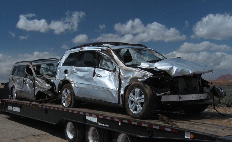 About 20 minutes into the drive, some winds picked up and reminded us how grateful we are at having a pop-up camper with its low profile. Anyone driving a pickup with a full-size camper would have had a hell-of-a-time dealing with the force of those cross-winds. I pulled into a rest stop to adjust the tie-down on our bikes, and was astonished to see the remains of a double-decker automobile transport truck. The driver had evidently fallen asleep earlier that morning, and rolled his rig and the 8 brand new Mercedes Benz SUV’s. Each of those cars must have stickered in at $50,000 each and, along with the tractor, and vehicle trailer, were absolutely totaled. The driver survived, however, and we’ll assume is seriously considering an occupational reevaluation.